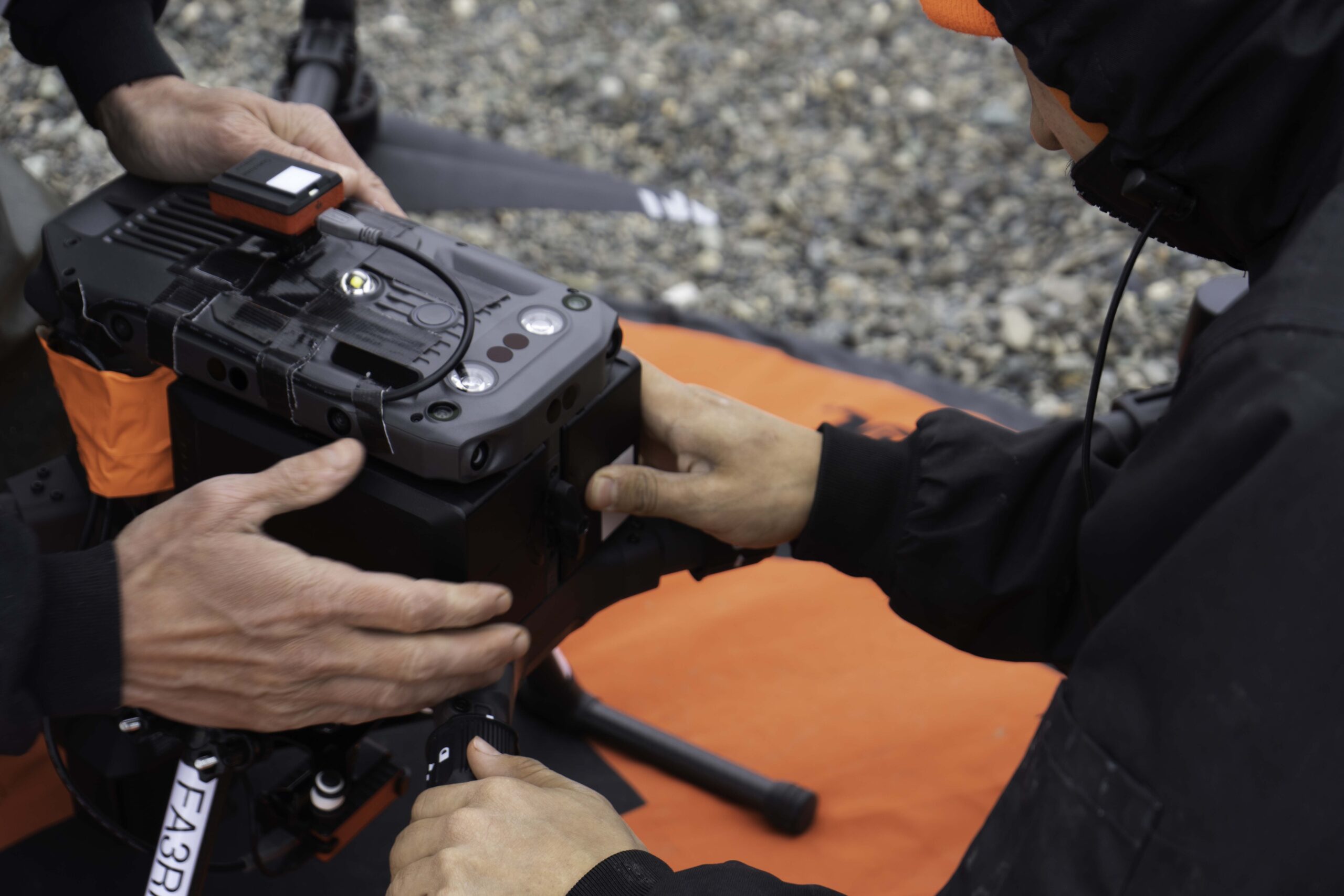
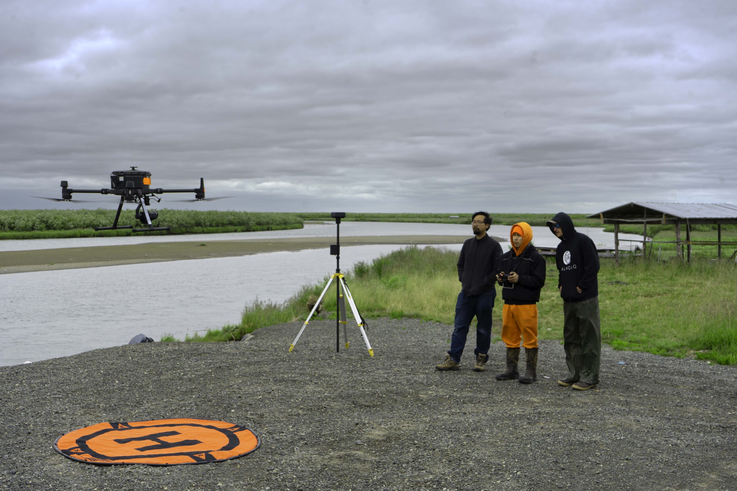
We use the latest technologies to map local infrastructure, subsistence areas, and ANCSA 14(h) allotments. Satellite remote sensing reveals how landscapes have changed over the last few decades, while multispectral imaging highlights vegetation and geological patterns including berry picking spots, mineral deposits, and more. UAVs (i.e., drones) allow us to map and inspect areas with centimeter-grade accuracy. We operate a fleet of specialized aircraft and sensors for all your 2D and 3D mapping needs.
UAVs provide a new perspective for monitoring environmental conditions.
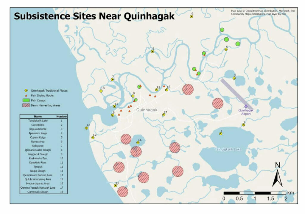
Landscape-Scale Mapping
Automated workflows combine old information with new datasets to create maps of local landscapes. We use these maps to monitor how subsistence sites are changing due to climate change.
Image: A community-based subsistence map of Yup’ik Placenames
Vegetation Monitoring
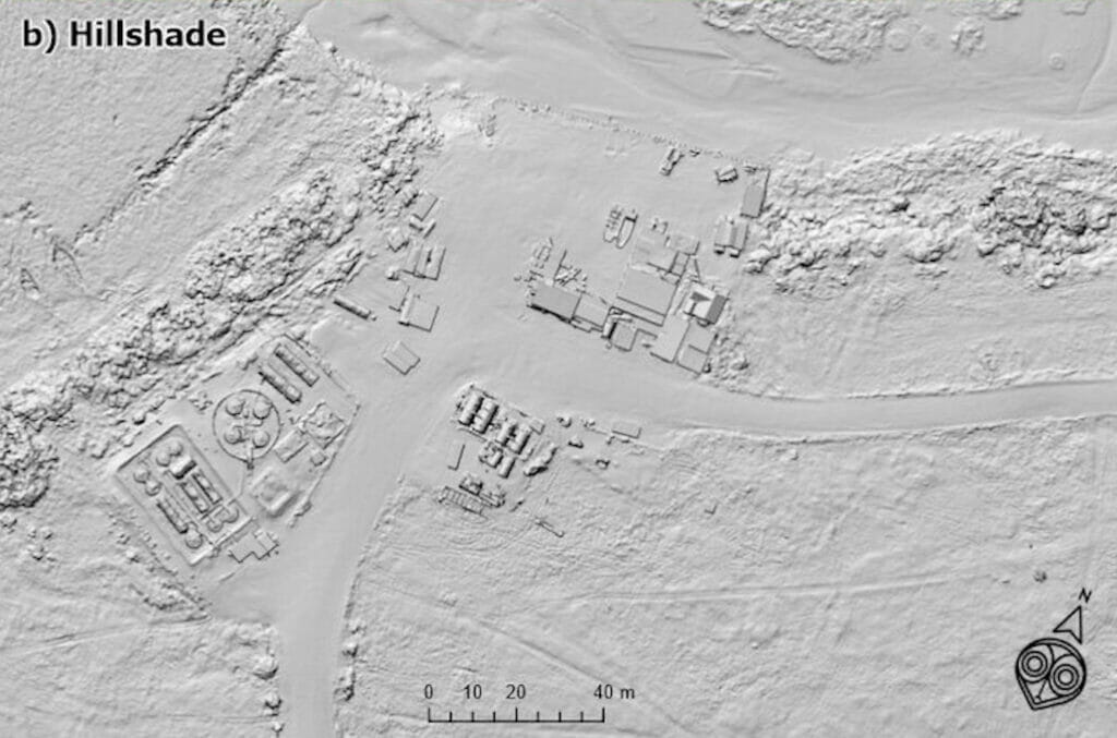
We use multispectral sensors and Machine Learning to study how vegetation changes at ancestral subsistence sites. In this image, the white outlines old sod homes of an abandoned village site north of Quinhagak.
Automated Change Detection
Automated Change Detection (ACD) classifies erosion based on the comparison of images. When combined with UAVs, ACD can provide higher-resolution data than satellite imagery.
Image: ACD identifies the extent of coastal erosion at Legen'ret near Quinhagak by comparing satellite data and historical maps.
See The Difference
Slide your finger or mouse over the maps below to see the difference between conventional satellite and UAV imagery.
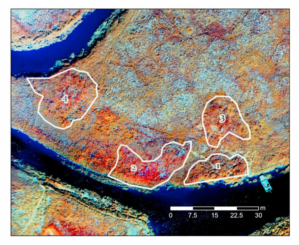
UAVs mounted with multispectral sensors highlight vegetation changes surrounding archaeological features like these 20th century fish processing pits.
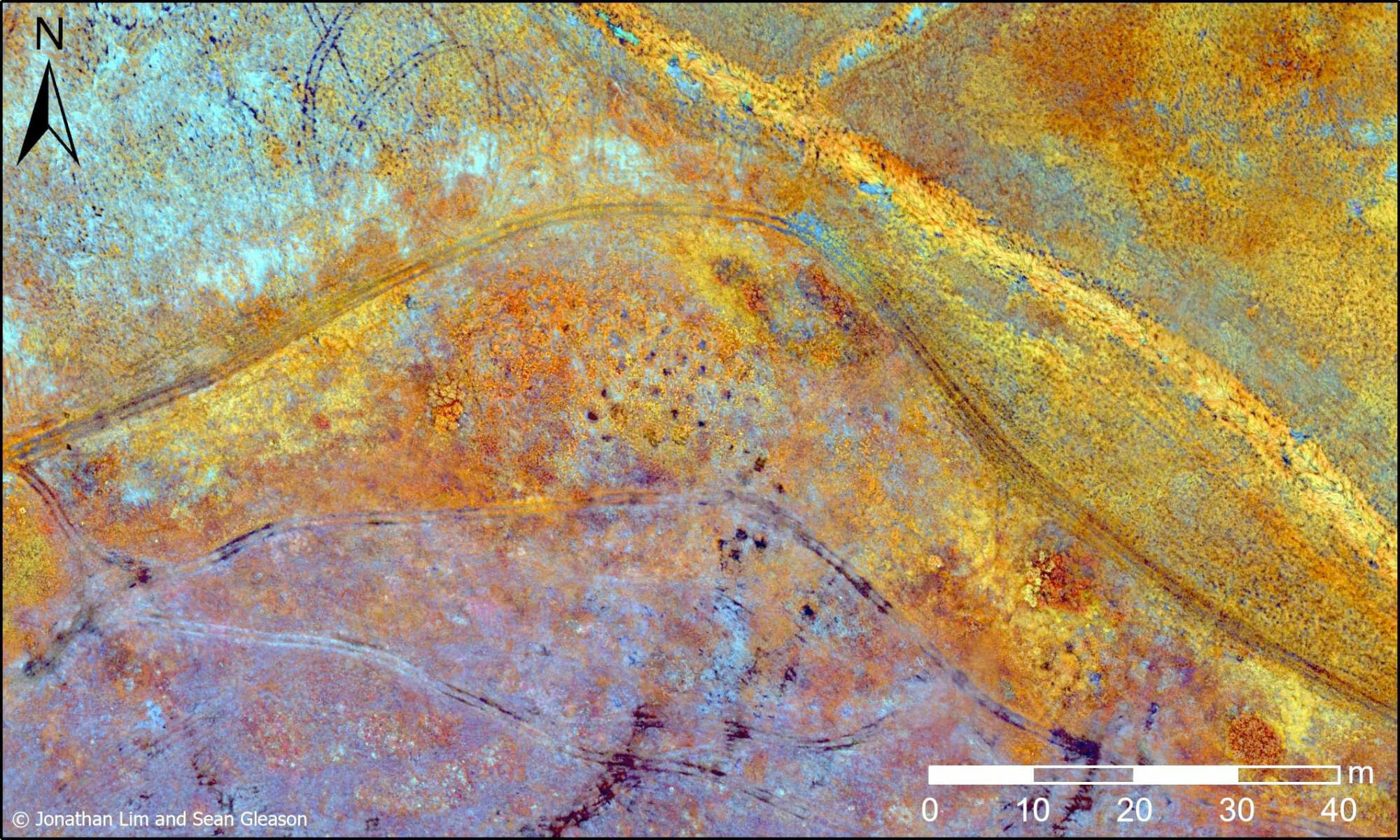
Multispectral orthomasics can also be combined with digital elevation models (DEMs) to detect ancestral sites. Here, this combination reveals pre-contact Yup’ik sod houses at an undisclosed ancestral site in the Y-K Delta.
Erosion Mapping
UAV-based remote sensing can help communities determine what areas are most at risk from coastal erosion. The map below illustrates one such erosion mapping project along the Qanirtuuq river. Shaded areas represent land lost to riverine erosion.
Training & Development
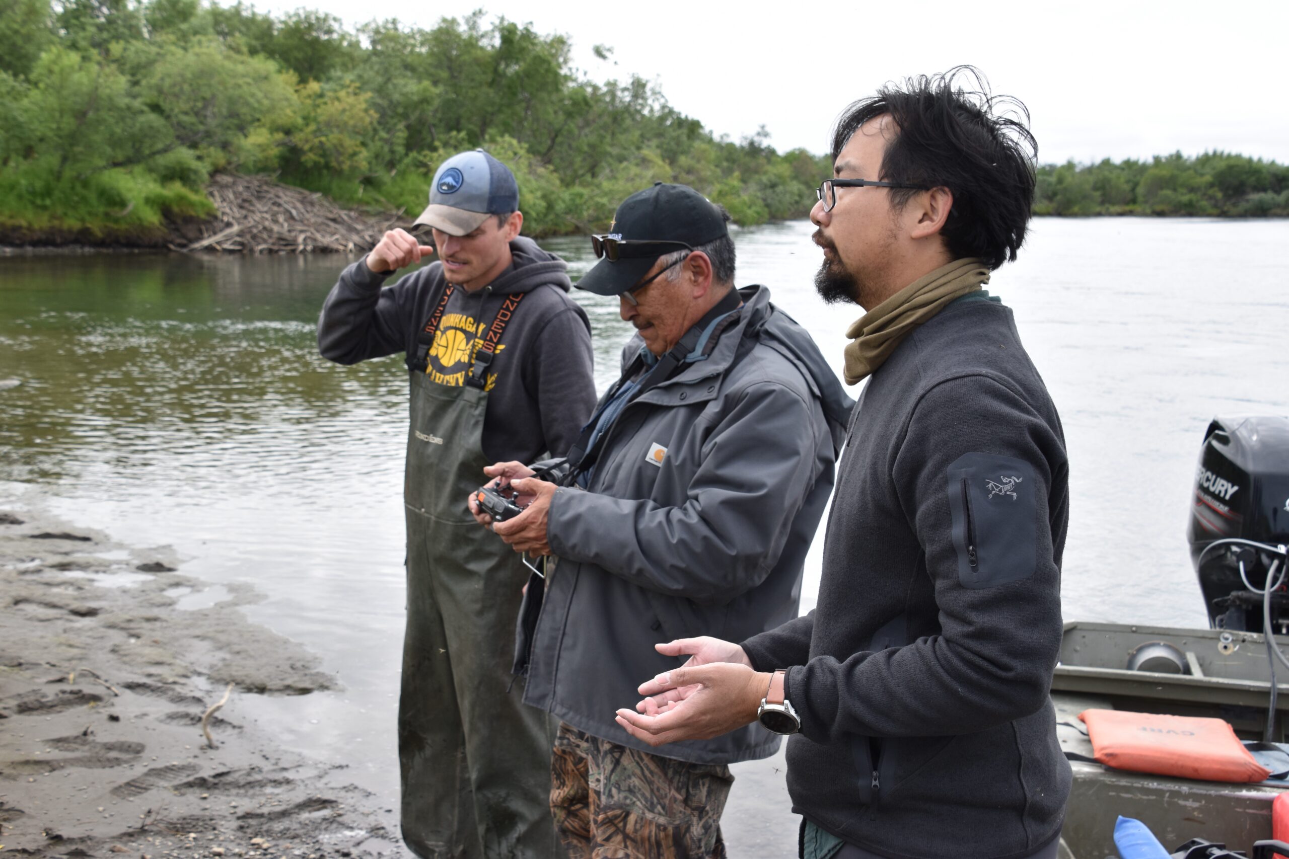
We offer training and development for individuals interested in learning more about UAV mapping and remote sensing. Our training includes custom UAV workflows to get your team familiar with basic UAV operations and photogrammetry.
3D Modeling
We offer training and development for individuals interested in learning more about UAV mapping and remote sensing. Our training includes custom UAV workflows to get your team familiar with basic UAV operations and photogrammetry.
Image: A 3D model of the village of Quinhagak.
Combining automated UAV flights with custom data processing allows us to 3D model locations with centimeter- grade accuracy. Today, 3D models are an important tool for monitoring community infastructure such as sewers, tank farms, and electric wind turbines.
Digital Elevation Models (DEMs) are another useful product to understand landscapes. Using a combination of satellite and UAV imagery we produce highly accurate maps of the topography in a given area.
Overall, 3D products from Nalaquq help reveal new aspects of a location or landscape.


